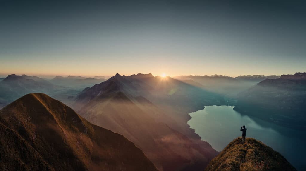
Just outside of Interlaken is one of Switzerland’s most stunning peaks: Augstmatthorn. The mountain stands at 2,137 meters and reigns over the region. Hiking up to the ridgeline offers panoramic views of the breathtaking Bernese Alps and Lake Brienz. Although it might be a strenuous journey, the sights and wildlife encounters make every step worth it.
You have two options to get to the top of the mountain. We’re going to go over the nitty-gritty details of each route and everything you need to know about the experience of the Augstmatthorn hike. So, put on your hiking boots, and let’s go!
Option #1: Harder Kulm to Augstmatthorn
Starting at Harder Kulm is how most hikers reach the peak of Augstmatthorn. The trail is not for beginner hikers, and you’ll need to do a little preparation beforehand. But if you’re looking for an all-day adventure and to fully immerse yourself in nature, then this might be the choice for you!

How to Get to the Trail Head from Interlaken
Head over to Interlaken Ost Station. Depending on where you’re staying in town, it should only be about a 15-minute walk or a quick drive away. You’ll also have the option of taking public transportation. A bus departs from the Zentralplatz stop every 10 to 15 minutes and will take you directly to Interlaken Ost.
By Funicular
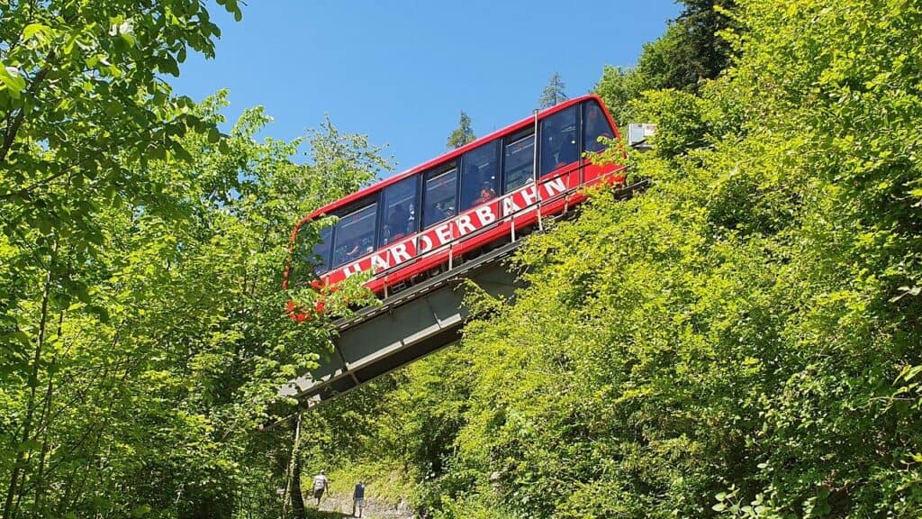
Once you’ve reached the station, take the funicular, which runs every 30 minutes, up to Harder Kulm. A one-way ticket costs 17 CHF, and a roundtrip ticket costs 34 CHF. Tickets can be booked here or in person. The funicular ride takes about 10 minutes, and it will give you a taste of the remarkable views waiting for you on the mountain. Keep in mind that the funicular begins running at 9:10am every day except for Sundays when it begins at 8:00am.

By Foot
If you want to experience an Augstmatthorn sunrise, the funicular isn’t going to take you up early enough. However, you can start at the crack of dawn and hike up to Harder Kulm. The 4-kilometer trail starts at Interlaken Ost Station and takes two and half hours, depending on your pace. This is the most strenuous hiking option, so be sure you’re up for the task and fully prepared with water and snacks.
Once you arrive at Harder Kulm, there will be signs by the restaurant–yes, there’s a restaurant up there – pointing towards Augstmatthorn. The trail has red and white markers to ensure you’re heading in the right direction.
What to Expect on the Harder to Augstmatthorn Hike
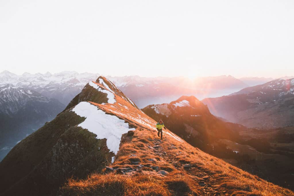
The beginning of the trail will start with an ascent through the forest. Don’t fret if it appears to be a cloudy day because chances are you’ll eventually hike above the clouds and have magnificent views of the region. As the trees become sparser after about 5 kilometers, you’ll find yourself hiking along the Harder ridge. If you’re afraid of heights, don’t worry because the trail is wide enough to never put you in danger.
The ridge will lead to Suggiture, another peak just before Augstmatthorn that you get to the summit. Follow the path that will get quite steep and rocky; however, you’ll find a handy rope to assist you in the more technical sections. At the top of Suggiture, there will be drop-dead gorgeous views, and it’s the perfect spot to break for lunch.
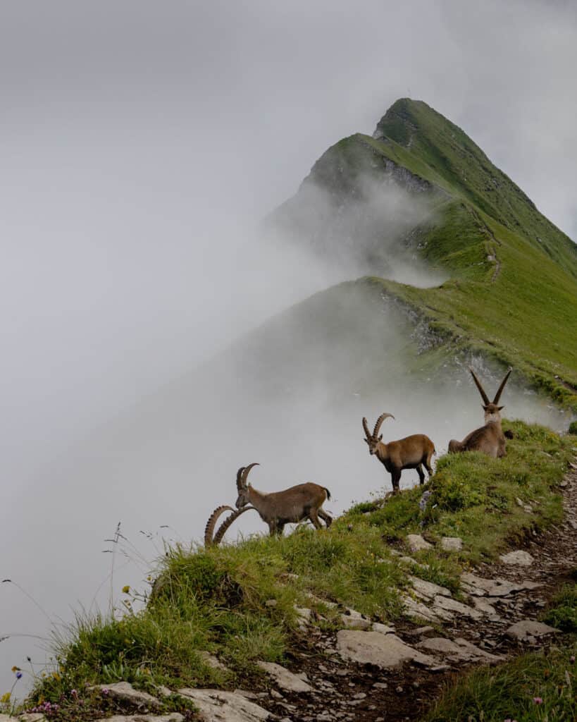
The path between Suggiture and Augstmatthorn is the narrowest section of the trail, but it’s undoubtedly the most breathtaking. Now is when you’ll have the chance to spot ibex and chamois–two different species of goats! Remember to always keep a safe distance from wild animals.

When you reach Augstmatthorn, you’ll be happy to find that summiting the peak is not as imposing as Suggiture. From 2,137 meters in the sky, the views of the mountain range and brilliant blue lake will leave you speechless.
Hike Difficulty
Hiking to Augstmatthorn from Harder Kulm is medium difficult. There are steep inclines but anyone in good health should be able to complete the hike, but you can expect to get sweaty!
Hike Duration and Distance
Roundtrip, the hike is about 16 kilometers. The amount of time to complete the hike depends on your level of fitness and how often you stop to take photos. In general, it should take around 3 hours and 30 minutes to reach the top and 2 hours and 30 minutes to make your way down.
Option #2 Lombachalp to Augstmatthorn
Don’t feel like hiking for 6+ hours? Well, starting in Habkern at the restaurant Jägerstübli Lombachalp will cut the trip in half and offer you the same wonderful views! The trail still demands uphill trekking, but it’s not nearly as strenuous as the other route. For those who want to see an Augstmatthorn sunrise, starting from the restaurant will be the best way to do it!
How to Get to the Trail Head
The easiest way to get to the trailhead is by car. If you don’t have access to a vehicle, I recommend taking a taxi. But you can reach Lombachalp as well with public transportation.
When you arrive at the restaurant, you need to pay for parking. Four hours should be enough time and cost around 8 CHF. Make sure to bring coins for the meter–some hikers reported being able to pay with a card. If you want to grab a bite to eat before or after the hike, just know that the restaurant opens at 10:00am.
The parking lot has a clear trail marker that will point you in the right direction!

What to Expect from Lombachalp to Augstmatthorn
Once you leave the parking lot, it won’t take long for the trail to become steep–you are climbing a mountain, after all. When you come across the fork in the road, keep left to continue towards the ridge, which you should reach in about an hour and a half. Along the ridgeline, you’ll have one of the best vantage points to soak in the scenery and photograph the mountains–don’t miss out on your chance to snap a picture!
The ridge trail will lead you to the peak of Augstmatthorn, where you can sit, relax, and have a few snacks. When you’re ready to keep moving, the ridge will lead you to Suggiture. Descending from its peak can be a little hairy, so take it slow and use the ropes for assistance.
You’ll continue down the ridge in the direction towards Harder Kulm. When you reach the first fork in the road, hook a right to make your way back to the parking lot. It’s an easy trail to navigate, and you’ll soon be able to see the restaurant and its parking lot.
Hike Difficulty
Although this route up to Augstmatthorn is shorter than the other route, you’ll still need to conquer precipitous hills and rocky terrain. Only people in good health and confident hikers should attempt this trail.
Hike Duration and Distance
Completing the 6.5-kilometer loop will take 3 to 4 hours, depending on how often you stop. If you don’t want to be in a rush, I recommend paying for at least 5 hours of parking to eliminate any stress about time!
What to Bring with You
Before going on a challenging hike, you should always pack the appropriate supplies to keep yourself safe. Here’s what I recommend bringing with you on the Augstmatthorn hike:
- Sunscreen
- Water (A lot of water)
- Snacks (Bring lunch for the longer route)
- Sunglasses
- A Band-Aid Box
- Hiking Poles (They’re a lifesaver on this hike!)
- Cellphone
While being prepared is important, you also don’t want to overload your backpack. Remember that these trails require a bit of scrambling, and you’ll want to have your balance!
What to Wear
No matter what month you’re planning your hike for, layers are king! You’ll want to wear pants, a t-shirt, and at least one long sleeve. When you’re hiking up mountains, the weather can be unpredictable. It would be smart to pack a rain jacket in case you run into a storm. As always, check the weather forecast to have an idea of what to expect.
Best Time to Hike Augstmatthorn
During the winter months, the Augstmatthorn is most often covered in snow and not walkable. The best time to summit the mountain is during Switzerland’s warmer months (May to September) until around mid november. However, even if you choose to hike in the middle of the summer, the weather can change very quickly in the mountains. Check the weather conditions before you go. If conditions look rough, postpone your hike until it clears up– the mountain isn’t going anywhere!
Final Thoughts
Hiking up Augstmatthorn is a wonderful experience that will be a highlight of your Switzerland trip. Not many places in the world can match its level of beauty. By the end of the hike, you may be tired and sore, but you’ll be grateful you had the opportunity to do the fantastic Augstmatthorn hike. Safe travels!
