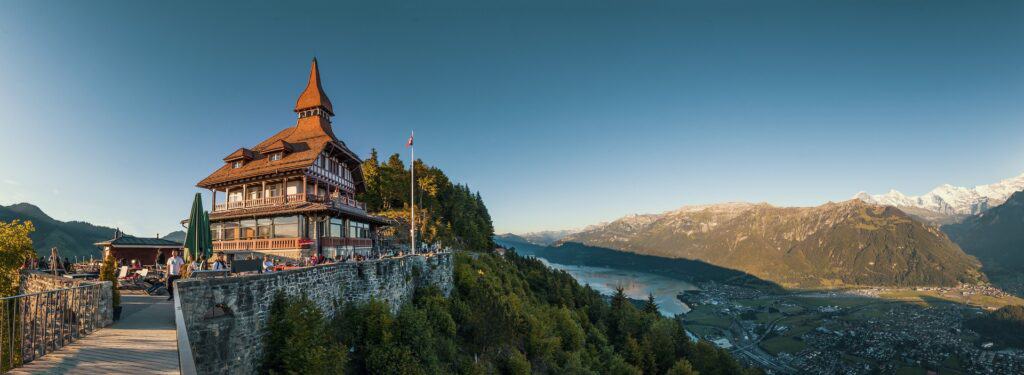
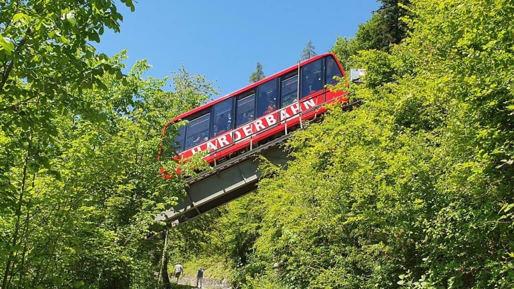
When you arrive in Interlaken, you might wonder about the strange looking building high above town. It’s the summit restaurant of the Harder Kulm – about a five minute walk from where the Harderbahn Funicular ends.
The bright red Harderbahn takes one up to the top in only 10 minutes. It’s an ideal excursion if one arrives late in the afternoon in Interlaken and it’s too late to explore the rest of the Jungfrau Region.
The panorama platform right in front of the restaurant offers a stunning view of the surrounding area, with Lake Thun and Brienz, Interlaken and of course the magnificent mountains.
There’s a network of hiking trails leading from and to Harder Kulm, most of them marked as mountain trails T2. It is the exercise mountain for locals who love a serious workout. I was lazy the day I went. My legs were still sore from the steep walk down from the Niesen the day before. I only managed to motivate myself to stroll along the “Elves Path” (Elfenweg). The romantic circle trail takes about an hour to complete and leads mostly through the woods, starting right at the Restaurant.

You might also like the following article:
The Legend of the Hardermannli (Harder man)
Do you wonder about the rock face you see at Harder Mountain?
Once upon a time, when monastic life in Interlaken was at its peak, monks couldn’t resist earthly temptations and stopped taking their vows of celibacy seriously.
One of the monks went for a walk at the Harder where he met an unsuspecting girl, collecting firewood. The monk approached her in a frivolous manner, and she fled in horror. He chased the frightened girl through the forest and that’s when she fell over the abyss to her death.
Heavenly judgment turned the monk instantly to stone and he was condemned to look at his place of crime for eternity.
The Harder Festival
Legends and myths come alive at the Harder Potschete in Interlaken. When life “between the lakes” was ruled by the convent, it became customary that masked teens and tweens from Interlaken and Unterseen visited the monastery at the end of the year to beg for a gift. They received bread, wine, and money, originally in the form of alms or “gifts for the dead.”
The masks are called “Potschen” which originates from “pig bladders” or “Süüblateri” in the local dialect.
Every year on January 2nd, Interlaken and Unterseen get haunted by the Hardermannli and the Potschen. They meet at the market square in Interlaken West and chase screaming spectators through the streets, hollering threats and beating visitors with the “Süüblateri”, the air filled pig bladders.
In addition, unmarried youth in disguise and with painted faces, move singing from house to house to beg for money, food and drinks (symbolic act of the “gift for the dead”).
Nice to Know
- Harder Kulm Funicular and Restaurant are open from the last week in April until end of the 3rd week in October (closed in Winter)
- Summit restaurant serves breakfast, lunch, dinner and snacks, open 9.30am to 9:15pm (on Sunday it is open from 8:30am to 9:15pm). Regular special folklore evening events take place. Nice terrace and inviting beer garden. You can even get married up there.
- Children’s playground next to the restaurant
- There’s a network of mountain trails that take between 1 to 5 and a half hours to complete. Pick up a trail map at the tourist office
- The Augstmatthorn Hike is a highlight in the region
- Alpine Animal Park near the entrance to the funicular that shortens waiting times for children. Can be reached from the Harderbahn on a small trail with steps. Not ideal for buggies. But further up the street is a vehicle-accessed road.

You might also like the following article:
Getting to the Harder Mountain
- The Harder Kulm Funicular station is located walking distance (about 10 minutes) from the train station Interlaken Ost and the Youthhostel Interlaken Ost, just across the River Aare;
- Swiss Pass Holders receive a 50% discount;
- A marked hiking trail zigzags all the way up from Interlaken Ost train station to Harder Kulm. The length of the hiking route is a little over 4 km (2.54 miles) and it takes about 2.5 hours to reach the restaurant at the top, at an altitude of 1322 meters (4337 feet). Altitude difference to overcome: 809 meter (2654 ft.).
